By Mrs Inkson (Head of Year 6)
This week, our Year 6 pupils have been developing their geographical skills as part of our PYP Unit of Inquiry on Human Migration. The focus this week has been on how physical characteristics influence routes taken by migrating people. A key part of their exploration was understanding contour lines and relief maps so that they can identify mountains on maps.
To bring these concepts to life, we took part in a series of hands-on activities. To introduce the idea of contour lines the girls were all given half a potato ‘hill’. They had to measure and mark equidistant increments around the side of the potato. Once they joined all the marks together in circles it made contour lines. If you then looked at the potato from the top you could see how the contour lines would appear on a map – closer together for the steep sides and further apart for the more shallow sides!
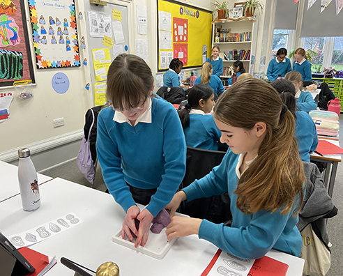
To consolidate this learning the girls were given images of hills represented by contour lines. They had to work together to interpret the contour lines to build models of different land forms and hills using play dough! It was a great fun and practical way to test their knowledge.
The girls loved pouring over maps of the local area to find the contour lines – they could find where they lived and see the lines representing hills that they are familiar with. Looking at world atlases showed relief maps of all the continents and the girls were interested to discover where in the world is most mountainous and where is relatively flat.
We are going to use all this learning to help us further understand the routes migrants choose to take when leaving their home countries and travelling by land.


