By Mrs McPhail (Geography Teacher)
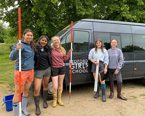
Liberated from being inside the classroom on a sunny June day the IB Geographers embarked on a morning of fieldwork on Wednesday covering five sites along the River Kym. Our first stop was just outside Kimbolton and our last near Hail Weston.
IB Geographers have to complete a piece of coursework known as the IA – the Internal Assessment which equates to 20% of the final mark.
We followed a route along the River Kym using maps and surveys devised by Bedford School’s Geography dept and apart from one site where access was tricky the students were able to get to grips with the regime of this local river. So, it was with our fieldwork equipment; dog biscuits, ranging poles, clinometers, measuring tapes and a sense of humour that the 5 enthusiastic geographers embarked on a morning of data collection.
At each site various measurements were taken such as the river's depth, width and velocity. The river levels were low given current weather conditions so our readings were quite varied. Each site was chosen to illustrate how the different variables impact the river and now the students are tasked with collating the data, coming up with hypotheses and presenting their findings to make their data come to life.
Using a GIS data collection technique was a new initiative this year with the Survey 123 app enabling the data to be geolocated. We await to see the results…
Izzy Harrison (Lower Sixth) said: “This was an enjoyable experience – at the first stop we were not working efficiently but by the fifth we were a dream team.”


.png&command_2=resize&height_2=85)


