Miss Fisher (Year 5 Teacher)
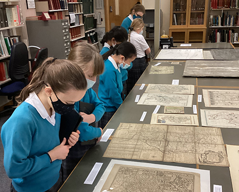
In Year 5, the girls have been unearthing a wealth of information in class about maps and explorers, including comparing old and new maps. On Tuesday 30th November, the girls went on an enriching trip to the Bedford Archives. This visit gave them a unique opportunity to study historic maps and documents.
In the Searchroom, the girls were able to take photos of the maps and draw comparisons to more modern-day maps upon their return to school. When exploring the old maps, they were excited to find the location of the school and discovered that Cardington Road had a different name originally. They also noticed how much less detailed the older maps were and how significantly more difficult this would make them to utilise in a modern context.
Whilst in the Stackroom, they were in awe with the number of boxes which contained documents about places all over Bedfordshire. The girls enjoyed locating boxes with the names of their own towns/villages. They also got to roll out an old map of where they wanted to build a railway, which almost stretched out along the whole corridor of the room. It was fascinating to discover all the different materials which maps have been made from over the years.
Charlotte (5F) said: “I enjoyed looking at the map that was made out of animal skin, I was interested in how it was stretched to make it smooth and thin to draw the map on it. I liked looking at the old maps that had been drawn rather than printed.”


